Running Trail Map Legend (Total Miles)
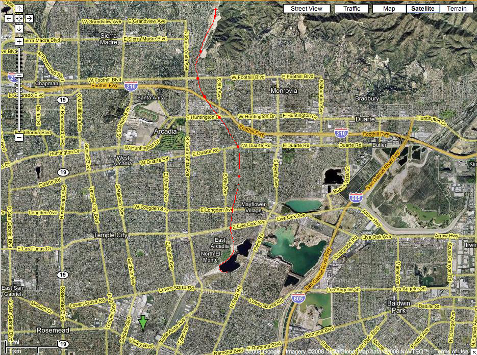
Posted on Mar 11, 2008 under Trail | No CommentHere is a quick guide to the number of miles each checkpoint is in our running trail. As I have said in a previous post, the trail begins at a water tower and is a bike path through a wash. We run along the path, which is adjacent to a nearby driving range/golf course. Halfway through the first mile, you can finally start running on a real dirt/rubble trail. Live Oak and beyond is pretty much a horse trail (actual horses run on it!) with some sandy parts, and gravel as well. Now that I think about it, it was pretty tough running on our trail, and there have been times when we have tweaked our ankles because of the surfaces, we always had to be aware of what was ahead of us.
Read the rest of this entry »